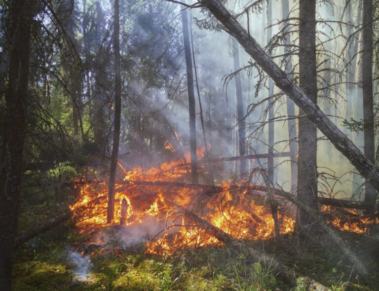
Satellites have become indispensable tools for assessing wildfires and minimizing their devastating impact on our environment and communities. In this post, we delve into fascinating capabilities of satellite technology and AI and their pivotal role in wildfire risk assessment, real-time tracking, and post-fire recovery monitoring.
Historical wildfires from satellites
When dealing with natural land, one of the most important factors for insurance companies, land developers, foresters and many other entities is how an area is prone to wildfire. A good place to start to assess the risk is historical wildfires. Ideally, every local government has built its own granular database, but that is not the case. That’s why we use historical satellite images year over year to build databases for clients.
Wildfires leave obvious marks on land that can be detected with visible light. However, short and medium range infrared is a better tool, particularly because it’s not easily blocked by clouds. The spatial scale and time horizon over many years makes algorithms much better than the human eye, that’s why we use machine learning algorithms to classify burnt areas year over year.
Satellite for Real-time Wildfire Risk Assessment
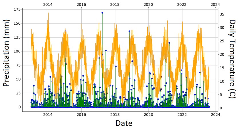
Taking into account historical events, we need to assess the risk in real time. The key to understanding real-time wildfire risk lies in recognizing the critical role of fuel. Live or dead dense vegetation, coupled with low moisture levels and moderate to hot temperature, plays a pivotal role in the initiation of wildfires. That’s why we don’t hear much about wildfires in Nevada, because wildfires have nowhere to start, nor in tropical forests in Thailand, where they cannot spread easily in moist conditions. Even in areas prone to wildfire, not all locations are equally susceptible, as factors like biomass availability, dead biomass on the ground, and moisture content vary across regions. By analyzing time series of satellite images, we evaluate these factors alongside temperature and precipitation patterns to create a dynamic wildfire risk assessment model. This approach, enhanced by machine learning and climate risk models, allows us to provide timely and accurate wildfire risk assessments.
Satellites for Tracking and Control of Wildfires
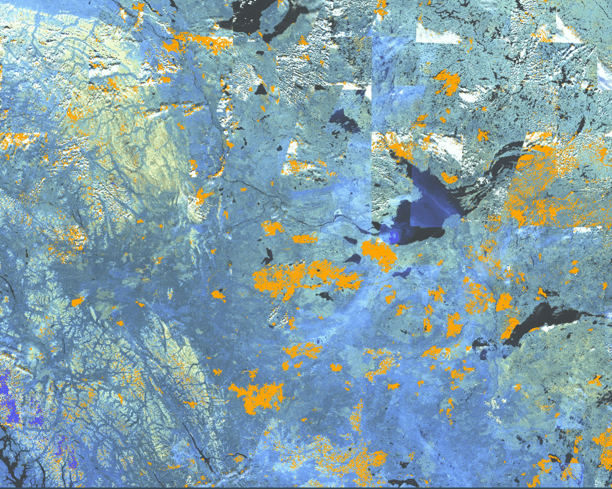
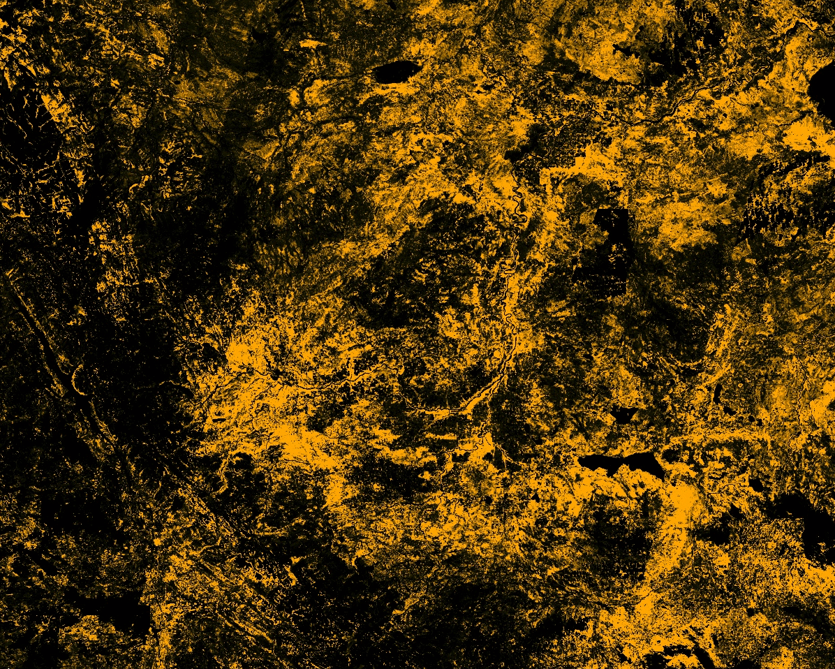
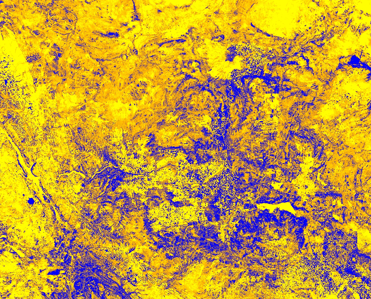
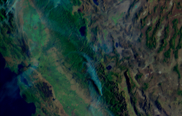
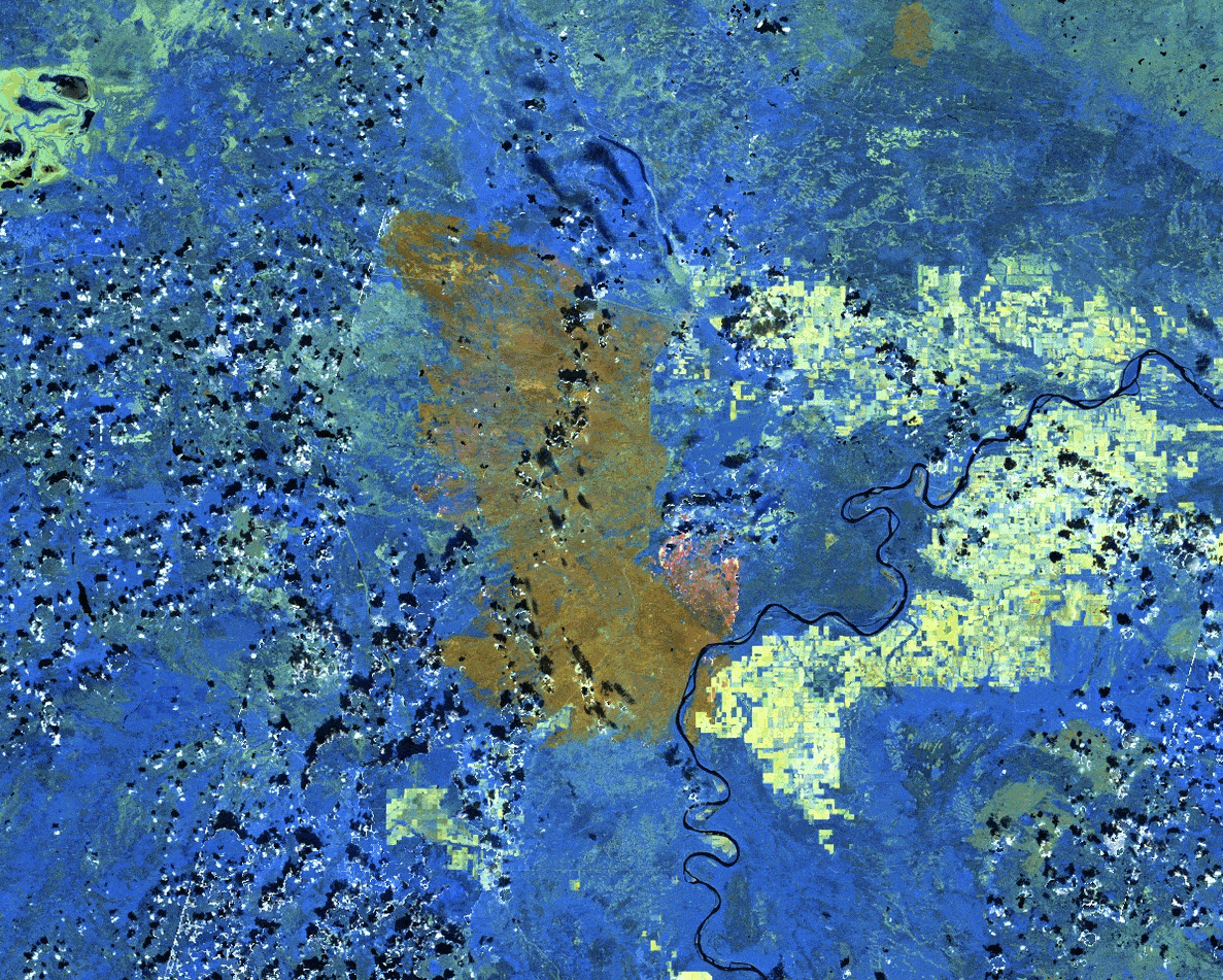
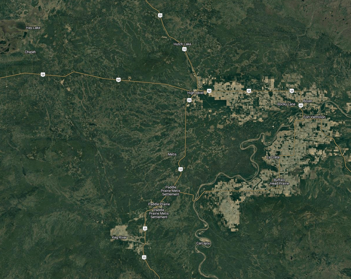
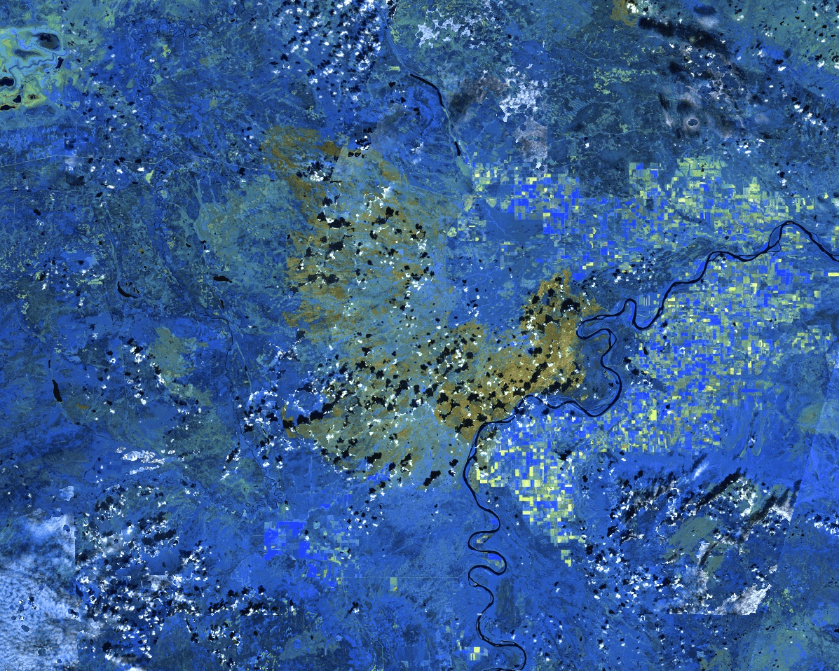
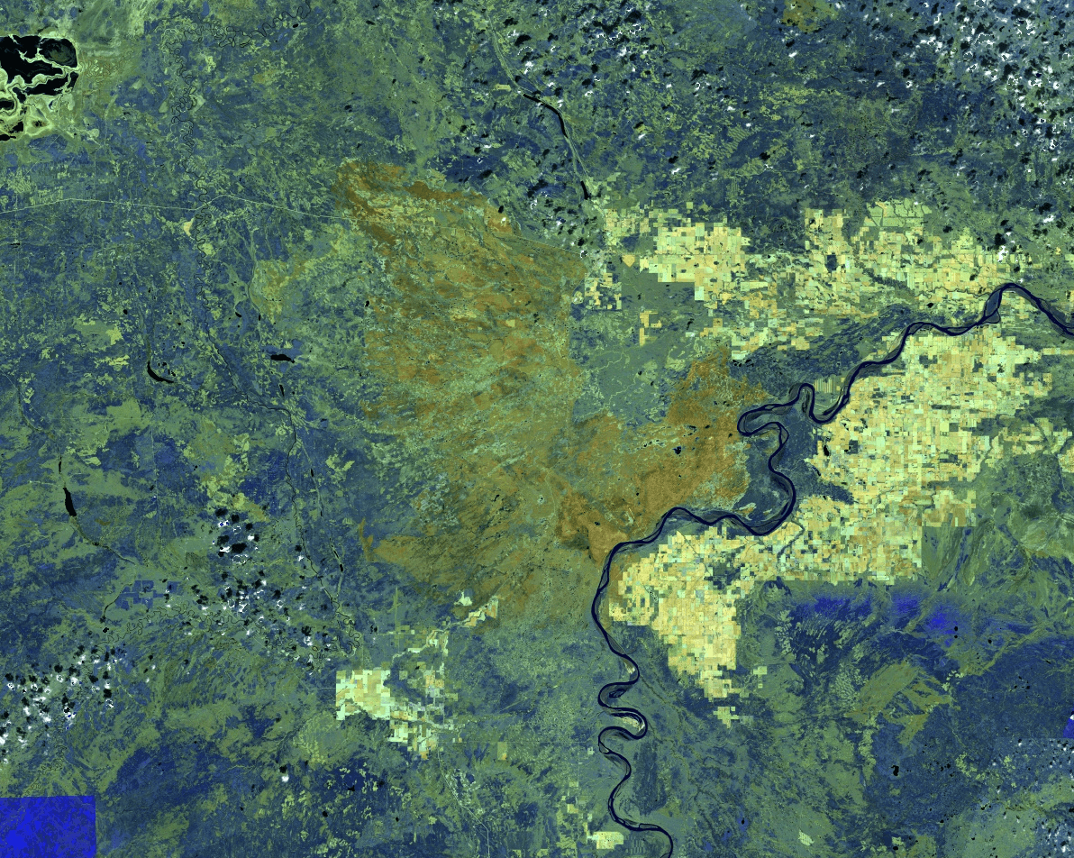
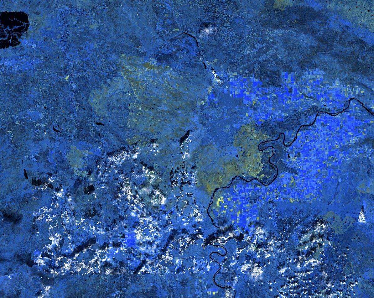
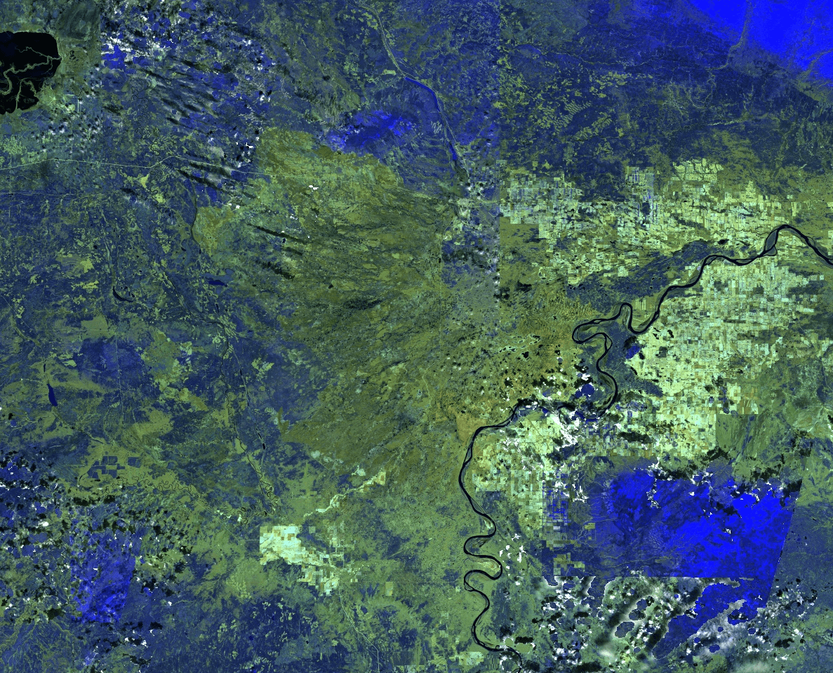
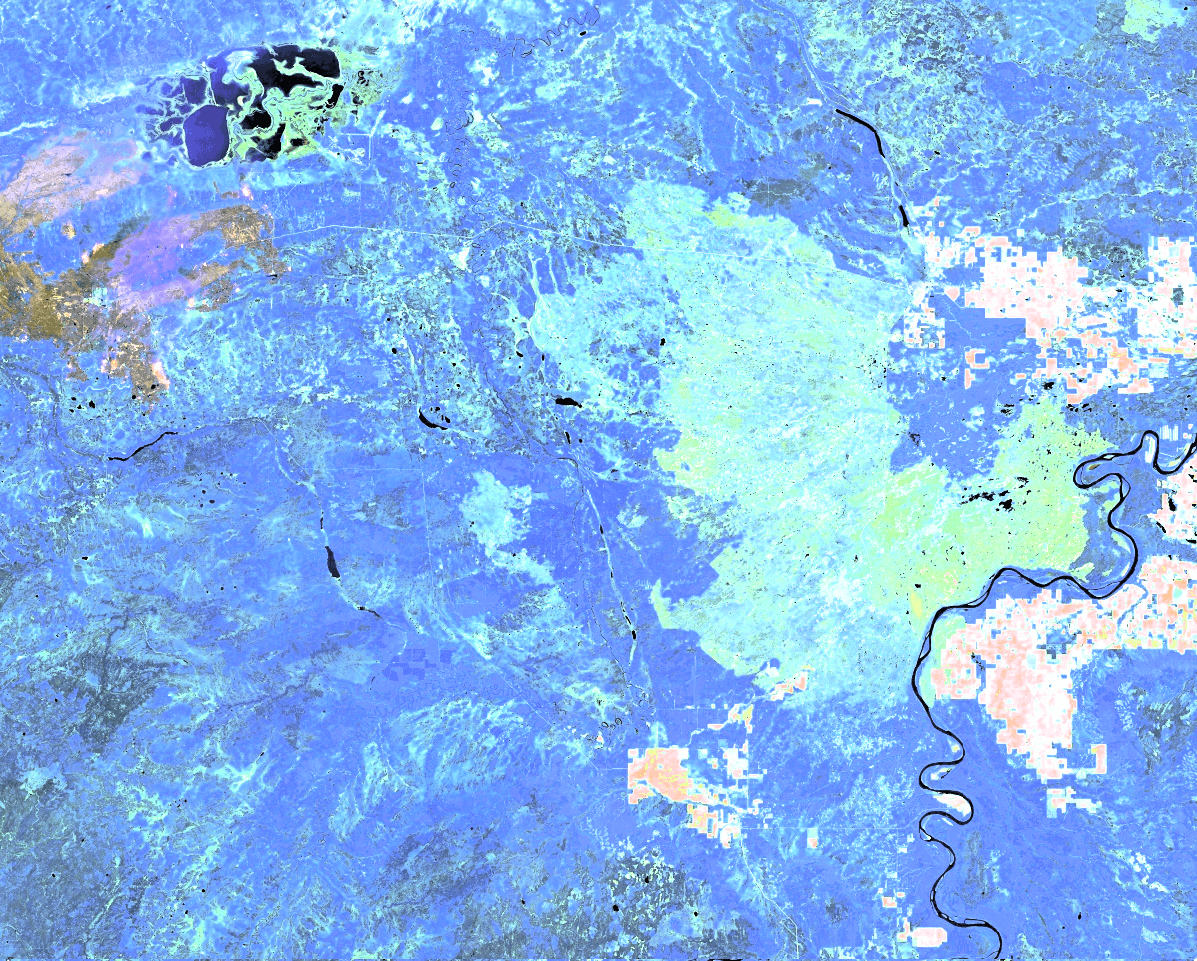
How Western Alberta is Prone to Wildfire
Live Vegetation
Dead Biomass
Water Content
Temperature Pattern
4 main inputs for real time wildfire risk assessment: live vegetation, dead biomass, water content and temperature pattern.
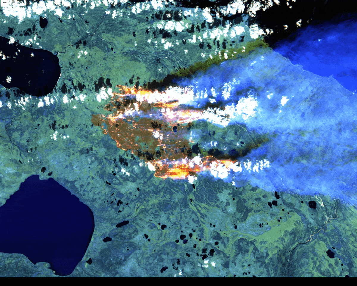
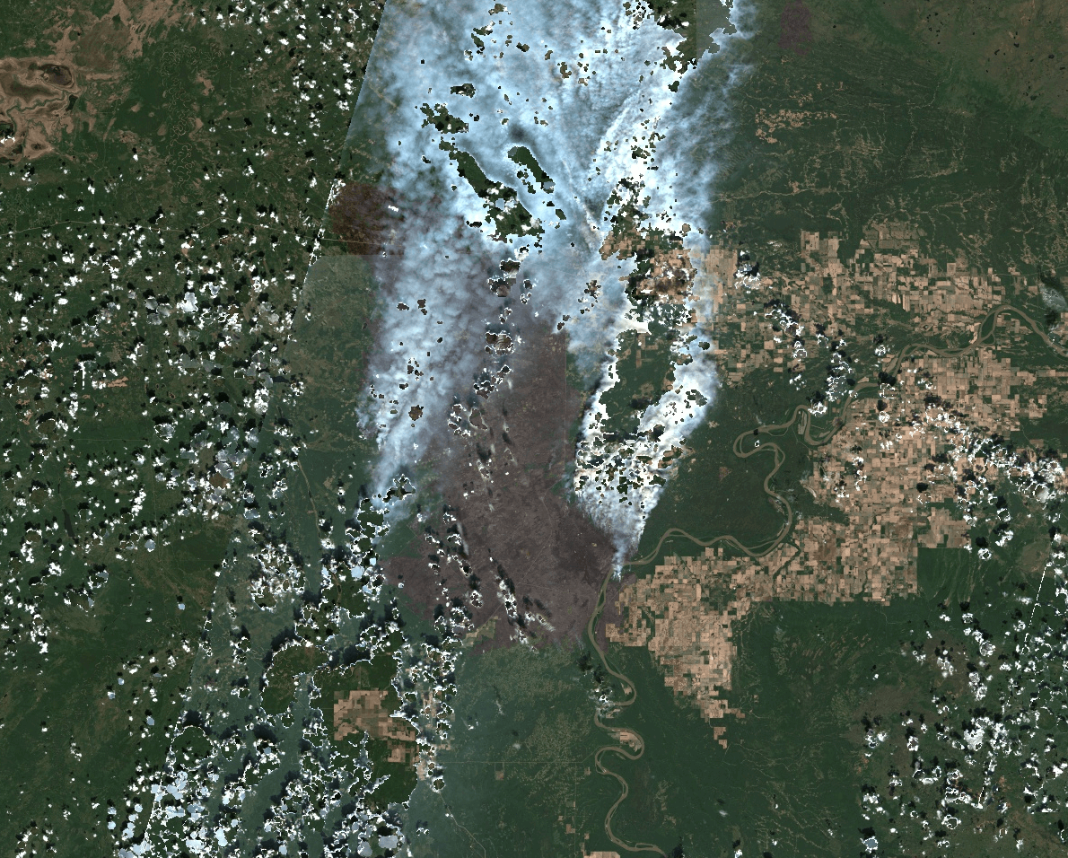
Satellites are essential for tracking the expansion and control of wildfires. Various constellations, such as the Visible Infrared Imaging Radiometer Suite (VIIRS), Geostationary Operational Environmental Satellite (GOES), and Moderate Resolution Imaging Spectroradiometer (MODIS), offer critical data for assessing the direction and scale of wildfires. By integrating data from multiple sources, we provide vital intelligence to firefighters and local communities, aiding in the minimization of potential damage.
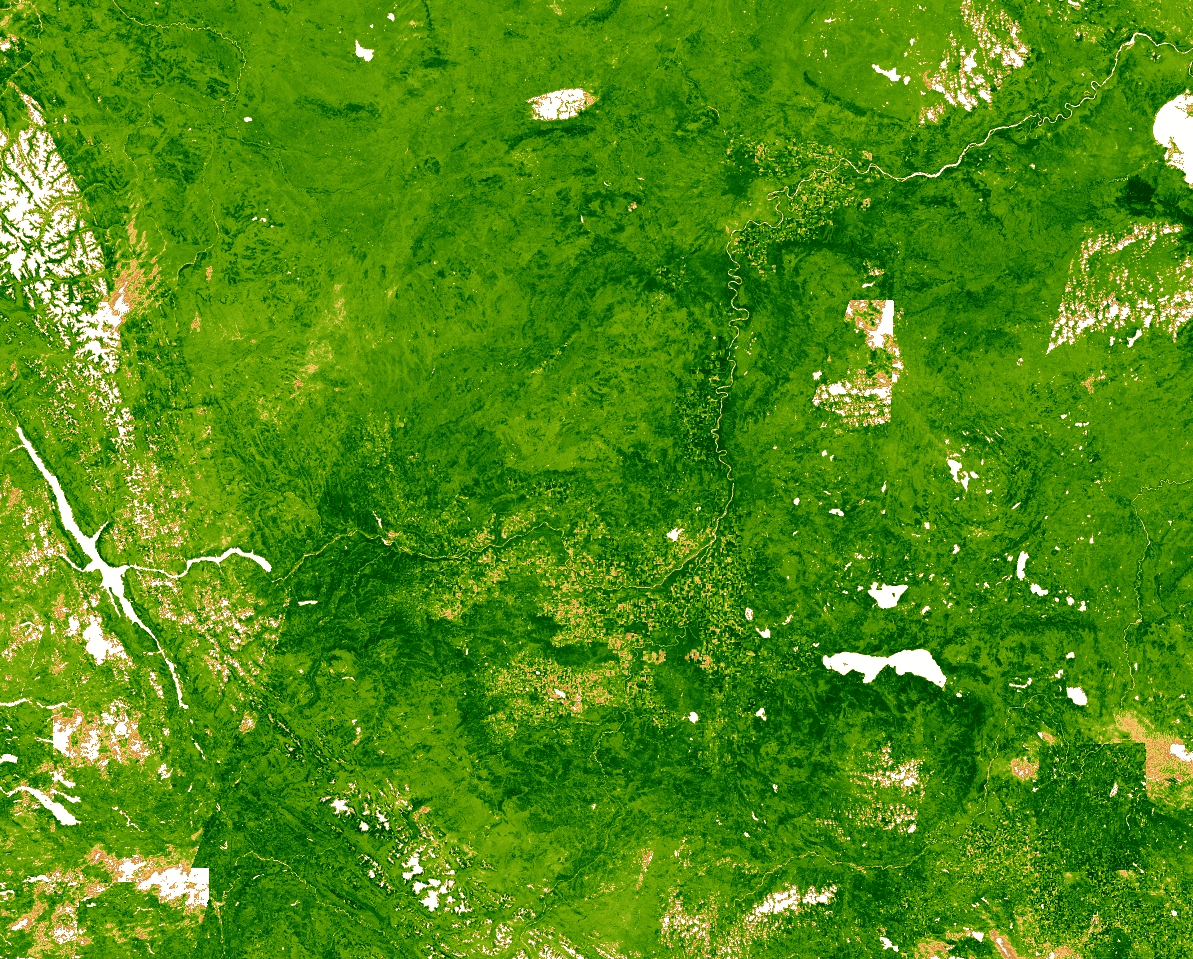
Tracking wildfire using Visible Infrared Imaging Radiometer Suite (VIIRS)
Geostationary Operational Environmental Satellite (GOES) imagery from wildfire in California in 2020 (source code credit: Justin Braaten)
Satellite images reveal not only the extent of the burnt area, but also the number, size and location of active fires in a fire patch. A crucial factor here is the ability of electromagnetic waves to pass through clouds, smoke and haze to detect fire fronts. For that reason, visual light (RGB) is not up to the task, but rather NIR, SWIR and IR spectrums are suited to detect flames or recently burnt (still hot ash) vegetation.
Assessing Damage and Monitoring Recovery
Once a wildfire has occurred, the focus shifts to assessing the extent of damage and monitoring the recovery process. While satellites cannot observe the repopulation of birds or insects, they excel at assessing the speed of vegetation regrowth. This capability is invaluable for understanding the long-term impact of wildfires on ecosystems.
Before wildfire
During wildfire
Burnt area
After 4 month
After 1 year
After 1.5 year
After 2 years
After 3 years – new fire!
Wildfire in Western Canada in 2019, and recovery of land (infrared spectrum) over next 3 years.
Conclusion
Wildfires are mostly natural occurrences, but their destructive potential can be mitigated through proactive assessment and monitoring using satellite technology. If you’re concerned about wildfires in your area, don’t wait for disaster to strike.
Take proactive steps to assess and mitigate wildfire risk by reaching out to us at info AT graindatasolutions DOT com. Our comprehensive wildfire risk assessment and cutting-edge solutions are at your service.
Together, we can safeguard our communities from the devastating impact of wildfires.