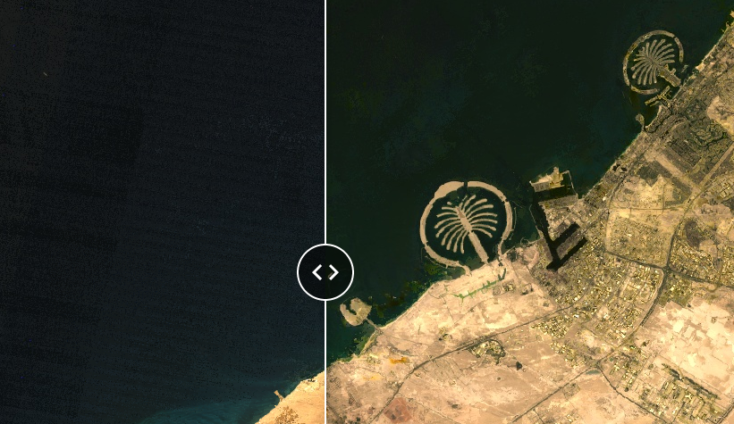
Interactive map of old satellite images
We’ve developed a FREE interactive web app that overlays Landsat images from the 1980s with those from 2024.
Table of Contents
Exploring Earth's Evolution Through Historical Satellite Imagery
In space, a fleet of satellites has been orbiting Earth for decades, capturing detailed images of our changing landscape. From the 1970s to today, these satellites have served as powerful tools, providing essential data that helps us understand how landscapes, weather patterns, and city growth have evolved. This information is invaluable for businesses looking to make informed decisions based on environmental and geographical insights.
The Landsat Program: Pioneering Satellite Observations of Earth's Surface
Imagine witnessing the birth of a city, the retreat of a glacier, or the transformation of a forest—all from space. Landsat’s historical imagery allows us to do just that. Whether tracking urban sprawl, monitoring agricultural productivity, or assessing environmental changes, these satellites have become our time machines, bridging the gap between past and present.
1. Landsat-1: Revolutionizing Earth Observation Since 1972
- Launch Date: July 23, 1972
- Mission: Landsat-1, the inaugural satellite of the Landsat program, revolutionized our understanding of Earth’s surface. Armed with multispectral sensors, it captured images across different wavelengths, unveiling patterns in land cover, vegetation health, and urban growth.
- Legacy: Landsat-1 set the stage for subsequent missions, providing a consistent record of our planet since the days of bell-bottoms and lava lamps.
2. Landsat-2 to Landsat-9: Continuously Enhancing Earth Imaging Capabilities
- Years of Operation: From the late 1970s to the present day
- Frequency: These satellites revisit Earth’s surface every 14 to 16 days.
- Data Richness: Landsat-2 to Landsat-9 continued the legacy, each contributing unique spectral bands and improved spatial resolution. They witnessed everything from deforestation in the Amazon to glacial retreat in the Himalayas.
This table offers a concise overview of the Landsat program‘s evolution, showcasing the advancements in spatial resolution, the expansion of spectral bands, and the consistency in revisit intervals over the decades. The launch and end dates mark the operational periods of each satellite, providing a timeline for this pivotal program in Earth observation history.
| Landsat Mission | Launch Date | End Date | Spatial Resolution | Number of Bands | Revisit Interval |
|---|---|---|---|---|---|
| Landsat 1 | July 1972 | January 1978 | 80m (MSS) | 4 (MSS) | 18 days |
| Landsat 2 | January 1975 | February 1983 | 80m (MSS) | 4 (MSS) | 18 days |
| Landsat 3 | March 1978 | March 1983 | 80m (MSS), 40m (RBV) | 4 (MSS), 1 (RBV) | 18 days |
| Landsat 4 | July 1982 | December 1993 | 30m (TM), 80m (MSS) | 7 (TM), 4 (MSS) | 16 days |
| Landsat 5 | March 1984 | June 2013 | 30m (TM), 80m (MSS) | 7 (TM), 4 (MSS) | 16 days |
| Landsat 6 | (Failed Launch, October 1993) | N/A | N/A | N/A | N/A |
| Landsat 7 | April 1999 | Ongoing (as of 2023) | 30m (ETM+), 60m (panchromatic) | 8 (ETM+) | 16 days |
| Landsat 8 | February 2013 | Ongoing (as of 2023) | 30m (OLI/TIRS), 15m (panchromatic) | 11 (OLI/TIRS) | 16 days |
| Landsat 9 | October 2021 | Ongoing (as of 2023) | 30m (OLI-2/TIRS-2), 15m (panchromatic) | 11 | 16 days |
Note:
- MSS = Multispectral Scanner
- RBV = Return Beam Vidicon
- TM = Thematic Mapper
- ETM+ = Enhanced Thematic Mapper Plus
- OLI/TIRS = Operational Land Imager and Thermal Infrared Sensor
Beyond Landsat: Exploring Other Old Satellite Programs
1. SPOT Satellites: High-Resolution Earth Imagery for Over Three Decades
- Launch Date: The first SPOT (Satellite Pour l’Observation de la Terre) satellite was launched in 1986. SPOT 7 is the latest that was launched in 2014.
- Spatial Resolution: SPOT satellites provided high-resolution imagery (ranging from 2.5 meters to 20 meters).
- Applications: SPOT data were used for land cover mapping, urban planning, agriculture, and environmental monitoring.
- Legacy: SPOT paved the way for commercial Earth observation, offering detailed views of our changing landscapes.
| SPOT Mission | Launch Year | Panchromatic Resolution | Multispectral Resolution |
|---|---|---|---|
| SPOT 1 | 1986 | 10 meters | 20 meters |
| SPOT 2 | 1990 | 10 meters | 20 meters |
| SPOT 3 | 1993 | 10 meters | 20 meters |
| SPOT 4 | 1998 | 10 meters | 20 meters |
| SPOT 5 | 2002 | 2.5 to 5 meters | 10 meters |
| SPOT 6 | 2012 | 1.5 meters | 6 meters |
| SPOT 7 | 2014 | 1.5 meters | 6 meters |
Note:
- Panchromatic: This mode captures images in black and white.
- Multispectral: This mode captures images in multiple wavelengths of light.
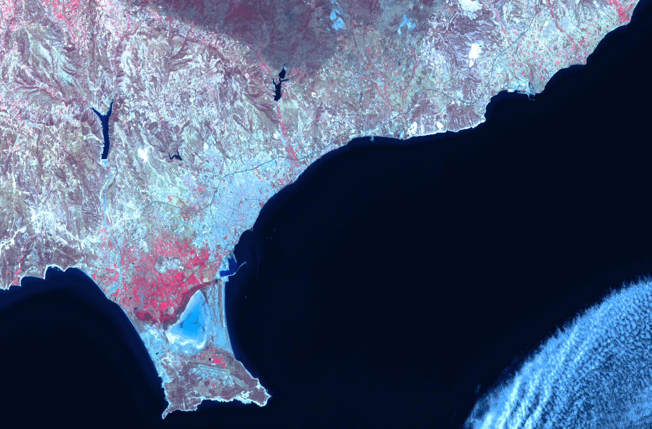
Landscape of Southern Cyprus in Summer 1995 (SPOT-2)
2. NOAA Satellites
- NOAA-6 to NOAA-19: NOAA (National Oceanic and Atmospheric Administration) polar-orbiting satellites have been capturing weather and environmental data since the 1970s.
- Data Types: NOAA satellites provide critical meteorological information, including cloud cover, sea surface temperatures, and atmospheric profiles.
- Impact: Their data aid in weather forecasting, climate studies, and disaster management.
GOES (Geostationary Operational Environmental Satellites) is one of NOAA’s satellites that was launched in 1975.
-
- Unlike polar-orbiting satellites, GOES satellites remain fixed above specific regions.
- Weather Monitoring: GOES provides real-time imagery of weather patterns, storms, and atmospheric phenomena.
- Legacy: GOES has been instrumental in severe weather prediction and monitoring.
3. Resurs-F
The Resurs-F series of satellites were part of the Soviet Union’s and later Russia’s efforts in Earth observation and remote sensing. These satellites primarily focused on natural resource monitoring, agricultural assessments, and environmental studies. Here are some key details about the Resurs-F series:
- First Launch: The Resurs-F series began operations in the early 1980s, with subsequent launches continuing through the 1990s.
- Mission Duration: Each satellite had an operational life of about 2 to 5 years, with new satellites launched periodically to replace or augment the capabilities of the constellation.
- Resolution: The imaging systems on these satellites could achieve resolutions ranging from 5 to 10 meters, which was quite effective for the technology and needs of the time.
- Camera Systems: The satellites were equipped with both wide-angle and high-resolution cameras, allowing them to capture broad swathes of terrain as well as more detailed shots of specific areas.
4. MODIS
- Launch Date: MODIS (Moderate Resolution Imaging Spectroradiometer) instruments flew aboard NASA’s Terra and Aqua satellites (launched in 1999 and 2002, respectively).
- Spectral Bands: MODIS offers a wide range of spectral bands, from visible to thermal infrared.
- Applications: It monitors vegetation health, sea surface temperatures, wildfires, and air quality.
- Global Coverage: MODIS captures data at a global scale every 1 to 2 days.
5. IKONOS: Pioneering High-Resolution Satellite Imagery
- Launch Date: Launched on September 24, 1999, IKONOS was the first commercially operated satellite to provide high-resolution optical imagery at resolutions of 1 meter.
- Spatial Resolution: IKONOS captures images with a resolution of up to 1 meter for panchromatic and 4 meters for multispectral modes, making it an invaluable tool for precision mapping and analysis.
- Applications: Its high-resolution imagery is crucial for various applications, including environmental monitoring, urban planning, and defense-related mapping. It has been particularly useful in creating detailed city maps and aiding disaster response teams in assessing damage post-disaster.
- Influence on Commercial Satellite Imagery: As the first commercial satellite to provide such detailed images, IKONOS revolutionized the availability of high-resolution imagery in the public and private sectors. It set new standards for satellite imaging, paving the way for subsequent commercial satellites.
- Operational Period: Although it was officially retired in 2015, the legacy of IKONOS continues through its extensive archive of images, which researchers and analysts continue to access for historical studies and longitudinal environmental monitoring.
Expanding Perspectives with Aerial Imagery
While satellite imagery provides a comprehensive view from space, aerial imagery offers a closer, more detailed perspective of the Earth’s surface. Utilizing aircraft and drones, aerial photography captures high-resolution images that are crucial for urban planning, real estate, and environmental monitoring. These images complement satellite data by providing additional clarity and precision, enhancing our understanding of specific areas and facilitating more informed decision-making. Additionally, archived aerial images serve as historical records, allowing us to trace the development of landscapes, urban expansions, and environmental changes over decades.
Here are some notable archives that house extensive collections of old aerial photographs:
- U.S. Geological Survey (USGS) EarthExplorer : The USGS EarthExplorer is an online search, discovery, and ordering tool for various datasets, including historical aerial images. This archive includes aerial photographs dating back to the 1930s, covering the United States and other areas globally.
- The National Collection of Aerial Photography (NCAP) : Based in Scotland, the NCAP is one of the largest collections of aerial imagery in the world, housing millions of aerial photographs, including those of the UK, taken during reconnaissance missions since before and during the Second World War up to the present day.
- Library and Archives Canada (LAC) : LAC holds a significant collection of aerial photographs primarily from the National Air Photo Library. The archive includes millions of aerial images covering all regions of Canada, dating back to the 1920s. These photographs are useful for anyone studying changes in landscapes, environmental assessments, or historical land use.
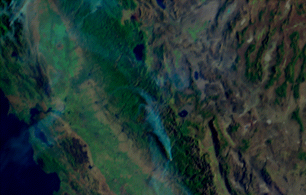
Aerial imagery map of the California, US
Comprehensive Imaging Solutions
Our journey through historical satellite and aerial imagery merges the rich history of Earth observation with cutting-edge technology, providing a unique perspective on the evolution of our world. This blog post, along with our interactive web app, opens the door to discovering these remarkable transformations. Embark on this exploration of time with us, and if your needs extend beyond what is publicly available, remember that we specialize in offering customized solutions tailored to your specific requirements. Whether you need detailed insights from specific years or broader historical data, our extensive archive of aerial and satellite images is designed to meet your diverse needs.
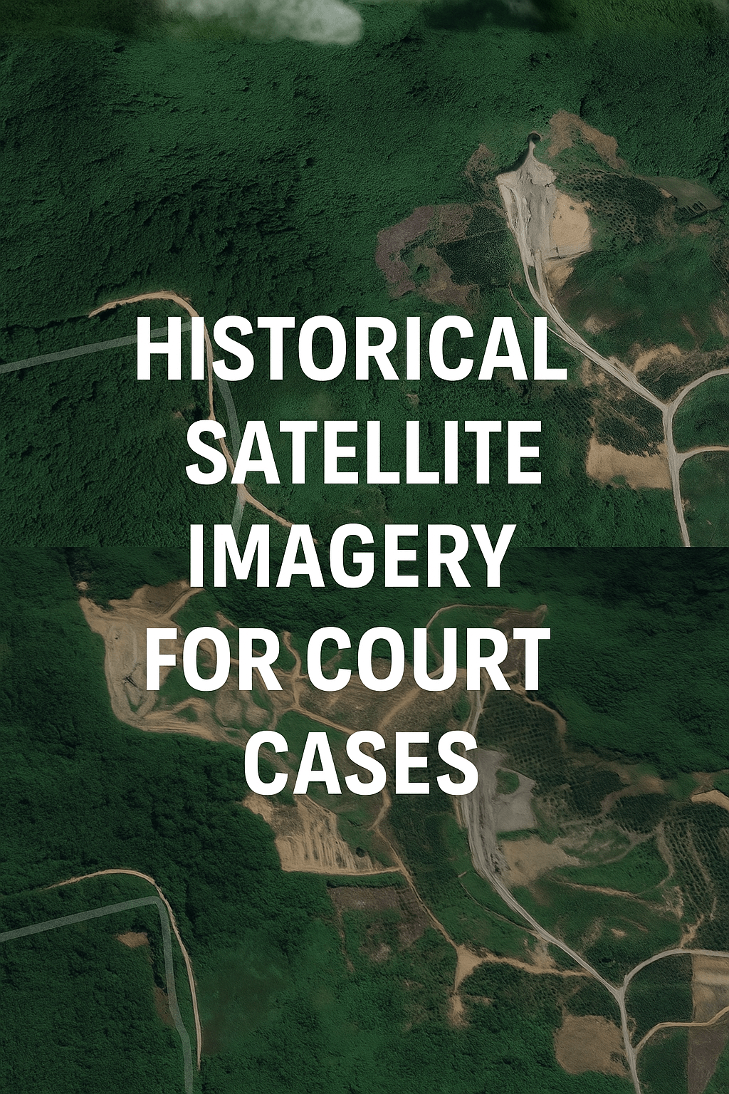
📌 Need satellite evidence for a legal or insurance case?
If you're looking for historical satellite imagery to support a court case, land dispute, or insurance claim, read our dedicated guide:
👉 How to Use Historical Satellite Imagery for Court Cases and Insurance Claims
📩 Contact us if you want to win your case with visual, court-grade satellite proof.

One Response