
When Do You Need Historical Satellite Imagery?
You might need archived satellite or aerial images if you are:
- Proving a building existed before a regulation cutoff
- Resolving land boundary disputes or encroachment issues
- Documenting natural events like floods or dam failures
- Supporting an insurance claim with pre- and post-disaster imagery
- Investigating land use violations or unauthorized developments
- Building a timeline of changes across decades (e.g., annual imagery from 2000 to 2010)
Why Historical Satellite Imagery Matters in Court Cases and Insurance Claims
Court and insurance matters often hinge on past conditions. But memories fade, paperwork gets lost, and on-site inspections are rarely retroactive. That’s where historical satellite imagery shines.
Key Advantages of using Historical Satellite Imagery for Court Cases and Insurance Claims:
- Unbiased Evidence: Timestamped imagery is impartial and legally credible.
- Visual Comparisons Over Time: Detect changes between specific years to track development, degradation, or damage.
- Large-Scale Coverage: Capture entire properties, watersheds, or regions—not just ground-level snapshots.
Real-World Use Cases for using Historical Satellite Imagery in Court Cases and Insurance Claims:
- Portugal: Landowners needed proof a structure existed before zoning laws changed. Imagery from 1989 confirmed it.
- Virginia, USA: After a pond drained in 1998, a family sought images to reveal the underlying creek.
- North Dakota, USA: Archival imagery was used to validate land features pre-damage for an insurance claim.
- India: Clients requested a time series from 2000 to 2010 to demonstrate land stability.
Availability of historical Satellite Imagery
We’ve written a complete post about old satellite images and their availability:
👉 Access Old Satellite Images – Interactive Tool
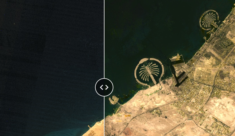
This includes an interactive map where you can compare satellite imagery of specific areas from the 1980s through 2024—a valuable resource when researching long-term land changes.
Here is a snapshot of that post;
| Year | Global Satellite Imagery | Aerial Imagery Availability |
|---|---|---|
| 1972 | Landsat 1 (60m) | Rare, mostly US |
| 1985 | Landsat 5 (30m) | Some Europe, US |
| 2000+ | Landsat 7 (15–30m), Ikonos (1m) | Widespread, commercial archives |
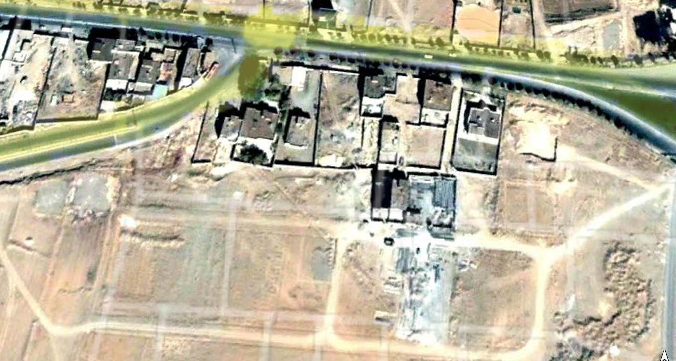
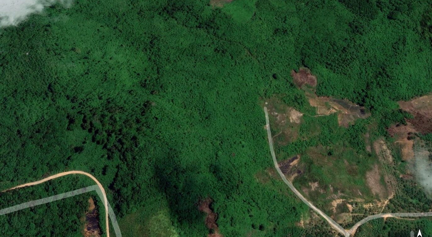
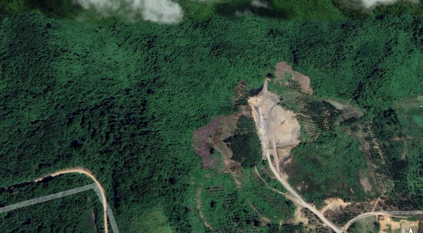
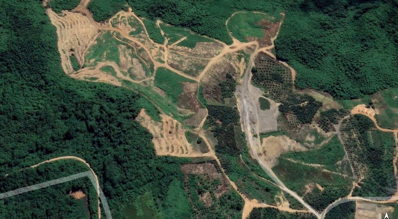
Satellite imagery of mining activity in East Kalimantan, Indonesia from 2019 to 2021, captured by Airbus and Maxar. These images show significant land transformation over time—serving as critical visual evidence in insurance claims related for environmental impact, land degradation, or operational compliance.
What We Deliver: Legal-Grade Insights from Historical Satellite Imagery
At Grain Data Solutions, we don’t just hand over image files—we deliver precise, actionable outputs tailored to your needs in court cases and insurance claims.
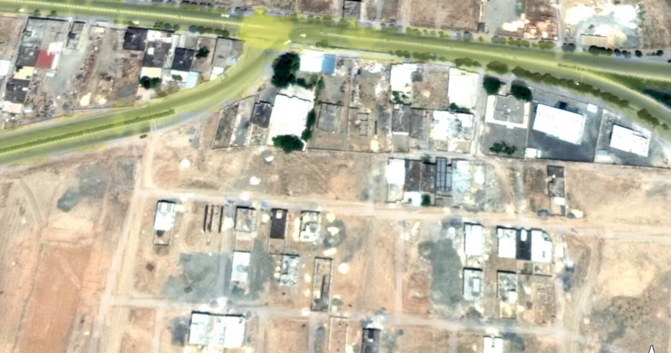
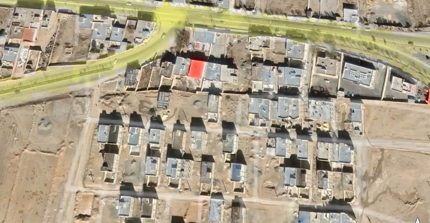
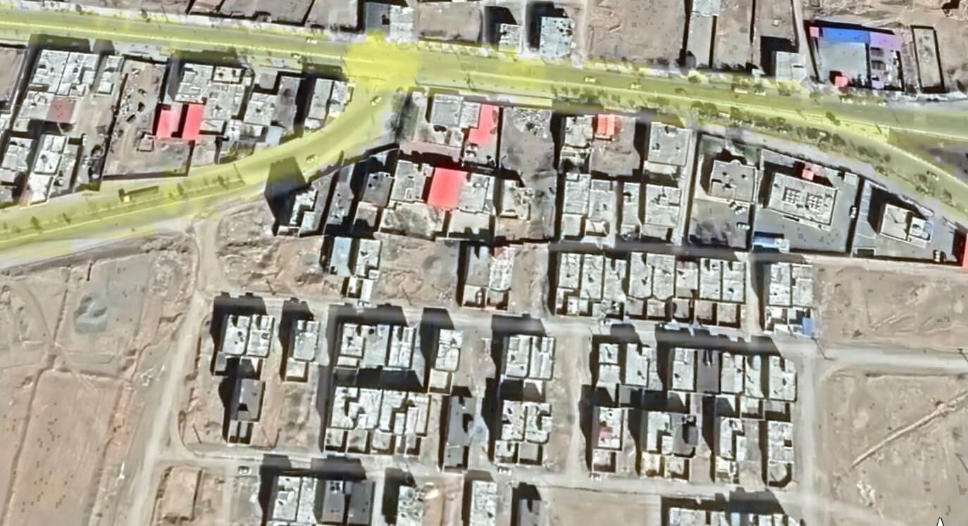
1. Locating Points of Dispute
We isolate exact coordinates within large imagery tiles, extracting only the relevant portions.
2. Advanced Image Analysis
- Anomaly & Change Detection: Spot encroachments, damage, or development.
- Land Use Classification: Differentiate between vegetation, built structures, or bare land.
- Vegetation & Terrain Indexing (NDVI, NDWI, etc.): Assess land conditions at specific times.
- Boundary Digitization: Precisely map fences, roads, water lines, or property edges.
3. Visual Timelines
We create time-lapse sequences to illustrate changes across months or decades—ideal for presenting historical satellite imagery in court cases or insurance evaluations.
4. Legal-Ready Deliverables
- Custom Reports tailored to dispute, claim, or regulatory context
- Interactive Web Tools for exploring imagery and layers. Explore our satellite imagery interactive tools
- Evidentiary Overlays such as parcel lines, water zones, or administrative borders
A Case-Ready Package - The result is not just imagery, but insight: a clear, defensible, and easy-to-understand package built specifically for court cases, reviewed by adjusters, or shared with expert witnesses. It’s built for real-world decisions—not just technical archives.
How Visual Evidence Supports Court Cases and Insurance Claims
Historical satellite imagery offers a defensible, third-party perspective that strengthens legal arguments, expedites claims, and often prevents disputes from escalating. Here are some examples of how these tools are applied:
Property Disputes:
- Confirm past boundaries, fences, or features
- Prove use or access rights with historical satellite imagery
Environmental Litigation:
- Show when and where environmental damage occurred
- Measure unauthorized land clearing or wetland disruption
Construction & Zoning Issues:
- Verify building timelines
- Prove compliance (or lack thereof) with permits
Natural Disaster Claims:
- Compare before and after-event images
- Establish whether reported damage aligns with visual data
Insurance Underwriting & Verification:
- Confirm previous structures or land features
- Detect inconsistencies in reported property details
Fraud Detection:
- Spot mismatches between claims and visible evidence
- Verify if damage predates a submitted claim